
The Rongai Route
The only route approaching from the north, near the Kenyan border. Drier than the southern routes, which makes it a common choice during the rains, and the least crowded of the established paths.
Rongai is the only Kilimanjaro trail that climbs from the north, starting in farmland near the Kenyan border and walking up through dry moorland in the mountain's rain shadow towards Kibo's eastern scree. It is the steadiest gradient on the mountain, the most reliable choice in the shoulder months, and the one route for which a modern peer-reviewed study of real clients exists — a finding worth reading carefully rather than quoting. This guide covers the walk, the Mawenzi Tarn acclimatisation day that separates a good Rongai itinerary from a weak one, and what that published number does and does not tell you.
Safaris That Include Rongai Route

Rongai Route Guide in Tanzania
The only route from the north
Every other trail on Kilimanjaro starts on the southern or western side of the mountain. Rongai starts on the north-eastern foothills, close to the Kenyan border, and it is the only approach from that direction.
Getting there involves a long drive round the base of the mountain from Moshi, past the eastern flank and up into farmland on the far side. Rongai Gate is one of the gates TANAPA lists, and the route sleeps in tents at designated campsites like every route except Marangu.
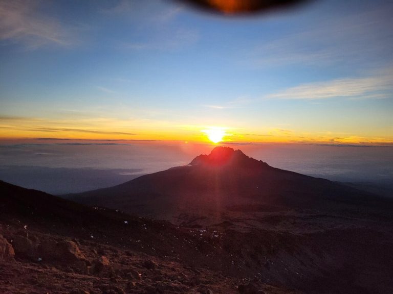
What you get for the drive is a different mountain. The north is drier, browner, emptier and considerably less photographed, and the view you walk towards for four days — Kibo's northern face, with Mawenzi's 5,149-metre spires off to your right — is one most Kilimanjaro climbers never see.
Why it is the dry side
This is not a marketing claim, it is geography. Moist air arrives at Kilimanjaro from the Indian Ocean to the south-east, is forced upwards by the mountain, cools and drops its water on the southern and western slopes. That is why the rainforest on Machame is a rainforest. By the time that air has crossed the summit it has very little water left, so the northern slopes sit in a rain shadow.
The practical consequence is that Rongai's forest section is short and thin rather than dripping and dense, and the route is the most reliable choice in the shoulder months. TANAPA's dry windows are late June to September and December to early March, with long rains from March to May and short rains in October and November. Those months belong to the bimodal north; if the rest of the trip runs south or west it is on a different calendar altogether, which is set out in Tanzania's two rainfall regimes. If your dates fall in or near the wet periods and you are committed to a tent, this is the route to look at first.
The trade is that the walking is less lush. People who describe Rongai as the least scenic route are usually comparing the northern moorland with the Barranco valley, and on that comparison they are right. People who describe it as dull have generally not been on the Saddle at dusk.
The shape of the walk
Rongai climbs steadily. In outline:
- From the gate into thin forest and out onto moorland. A gentle first day on a path that climbs consistently rather than in steps.
- Up the northern slopes. Open country, dry underfoot, with the mountain directly ahead and very few other groups in sight. Longer itineraries break this into two days and include the Mawenzi Tarn detour.
- Onto the Saddle. The route crosses the high desert plain between Mawenzi and Kibo to a high camp beneath Kibo's eastern scree. Itineraries differ on exactly which camp; some join the same Kibo Hut, at around 4,700 metres, that Marangu uses.
- Summit night. Up the eastern scree to the crater rim in the dark, round the rim to Uhuru Peak at 5,895 metres, then a long descent.
The defining characteristic of that profile is that it is even. There is no day on Rongai with a brutal climb in it and no scramble anywhere. For walkers who would rather go up a consistent gradient for five days than alternate between hard days and easy ones, it is the most comfortable route on the mountain.
Mawenzi Tarn, and the acclimatisation question
An even gradient is pleasant and it is not automatically good for you. What the mountain's better profiles do is take you above your sleeping altitude during the day and bring you back down for the night, and a route that simply climbs at a steady rate does less of that.
The fix is built in, and it is the thing to check for when you compare itineraries. Longer Rongai trips include a night and a day at Mawenzi Tarn — a small lake in a cirque directly beneath Mawenzi's western face, and the most striking place on this side of the mountain. The extra day there is spent walking up and coming back to the same camp. That is the climb-high-sleep-low stimulus, and without it a short Rongai itinerary is just a steady plod towards the Saddle.
If you are choosing between a Rongai itinerary with a Mawenzi Tarn day and one without, the one with it is a materially better trip for reasons that have nothing to do with the view. The physiology is set out in the main Kilimanjaro climbing guide.
The one published number, and what it means
Rongai has something no other route on Kilimanjaro has: a modern, peer-reviewed measurement of what happened to a group of real clients.
A study published in Wilderness & Environmental Medicine in 2016 followed every trekker who travelled with a single Australian tour company between August 2012 and July 2014. All 175 of them climbed Rongai and attempted the summit on day six. Eighty-eight per cent reached the summit. Just over half met one definition of acute mountain sickness and about a quarter met a stricter one. Being 40 or over, and being female, both predicted not summiting — though neither predicted getting sick. The authors' conclusion was that this six-day profile did better than the four- and five-day ascents described in earlier work.
Four things have to travel with that number or it becomes a lie.
- It is one company's clients, not the route's population. Operators differ enormously in pace, guiding and how hard they push.
- It is a self-selected group — people who chose a longer itinerary through a Western operator are not a random sample of everyone on the mountain.
- It is a decade old.
- It is not comparable to any figure you have seen for another route, because no equivalent study exists for any other route. It is not evidence that Rongai beats Lemosho; it is evidence that a six-day profile beat the four- and five-day profiles that had previously been measured.
Read properly it is still the most useful number on this mountain, and it says what TANAPA says: give yourself more days.
Crossing the mountain
Rongai does not come down the way it went up. Itineraries cross the summit area and descend on the south-eastern side by the Marangu path, which means you walk up one flank and down another and see two quite different mountains in a week — dry northern moorland on the way up, the hut route's forest on the way down.
The park requires you to leave by the gate named on your permit, so confirm with your operator which one that is when you book. It also means your transport has to meet you a long way from where it dropped you off, which is routine but worth knowing if you have left luggage somewhere.
Who it suits
It suits anyone travelling at the edges of the seasons or into the rains; walkers who prefer a steady consistent gradient to alternating hard and easy days; people who want a quiet mountain without committing to the full Northern Circuit; and anyone who wants to see both sides of Kilimanjaro rather than one.
Look elsewhere if the scenery is the reason you are going — the southern routes have the glaciers, the giant groundsels and the Barranco valley, and Rongai has none of those. Look elsewhere if you want a hut, which is only Marangu. And be careful of short Rongai itineraries without the Mawenzi Tarn day: the route's gentleness can disguise a profile that is not doing much for you. How many nights the mountain needs, and what the days either side of it cost, is worked through in the decision that comes before the route choice.
Common questions
Is Rongai really the driest route?
It is the only one on the northern side, and the northern slopes sit in the mountain's rain shadow, so yes in the meaningful sense. It does not mean you will stay dry, and it says nothing about conditions above the moorland, where weather arrives from any direction.
Is Rongai easier than Machame?
The walking is easier — no scramble, gentler gradients, no long traverse. Whether it is an easier climb depends on the itinerary, because a steady ascent without a climb-high-sleep-low day gives your body less to work with.
Does it start in Kenya?
No. The trailhead is in Tanzania on the north-eastern foothills, not far from the border. The whole climb is inside Kilimanjaro National Park and you enter and leave the park through Tanzanian gates.
How quiet is it?
Genuinely quiet for most of the ascent. You rejoin the crowd on summit night, where groups from the Marangu side are climbing the same eastern scree at the same hour.
Does the 88 per cent figure apply to me?
No. It describes one company's clients on one itinerary a decade ago. What you can take from it is the direction of the finding: a six-day profile did substantially better than the shorter ones that had been measured before it.