Why you stop at Mto wa Mbu
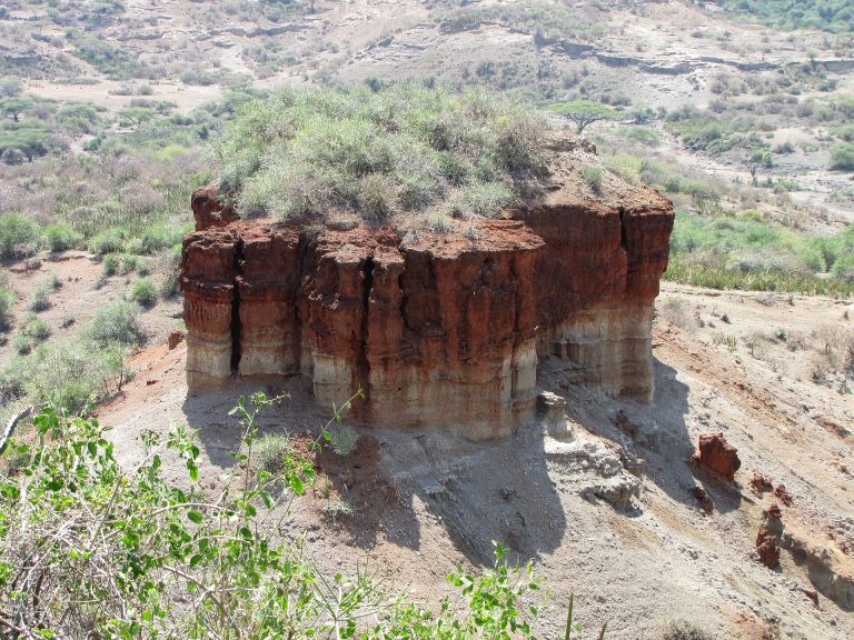
Mto wa Mbu sits at the bottom of the Rift Valley escarpment, where the road from Arusha drops off the plain and everything abruptly turns green. TANAPA places the main gate of Lake Manyara National Park close to the town at the base of the escarpment, and gives the park as just south of it — which makes Mto wa Mbu the park’s front door and, for most visitors, a place seen through a windscreen on the way somewhere else.
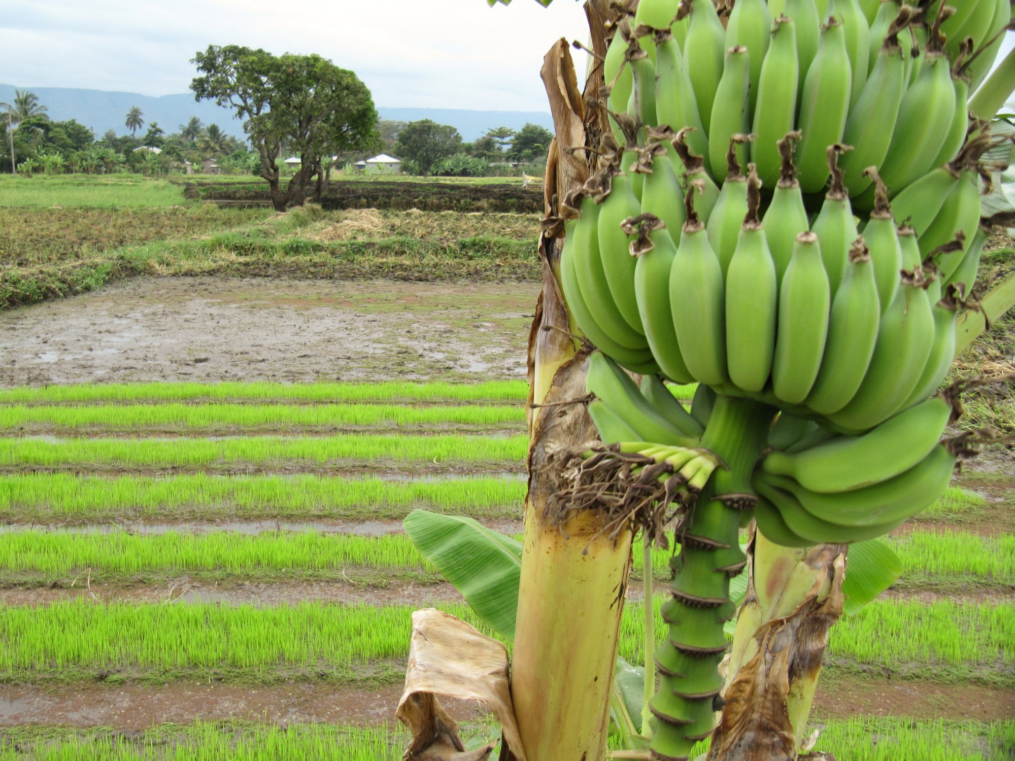
It is worth more than that. The town is an irrigated oasis in an arid stretch of Rift floor, fed by streams coming off the escarpment above it, and it is one of the few places on the northern circuit where the thing you look at is people farming rather than animals grazing. Travellers who stop here usually do so for a half day of walking, cycling and eating between park days, or to sleep somewhere cheaper and more ordinary than the lodges.
Where it is, and what the name means
Mto wa Mbu is Swahili for river of mosquitoes, and there is a real river of that name: Monduli District Council lists Mto wa Mbu among the district’s perennial rivers, alongside the Simba, Kirurumo, Selela and Engaruka. The town takes its name from the water, and the water is why it exists.
Administratively, Mto wa Mbu is a ward of Monduli District Council in Arusha Region, in the district’s Manyara division. The district’s Rift Valley zone is described by the council as arid, with temperatures from 23 to 35 degrees and under 500 millimetres of rain a year — which makes the rice paddies and banana groves around the town an entirely artificial piece of landscape, and the reason people have moved here from all over the country to farm.
The practical geography is simple. Mto wa Mbu is on the tarmac between Arusha and Karatu, at the foot of the climb up the escarpment. Lake Manyara’s gate is at the edge of town. Karatu and the Ngorongoro gate are up the hill to the west. The turning north towards Lake Natron and Ol Doinyo Lengai leaves from here. TANAPA puts the whole run from Arusha at around 125 kilometres and two to two and a half hours. Distances on the northern circuit are short on paper and long in practice, which the guide to how long Tanzanian journeys really take covers.
The mixed town
Mto wa Mbu is widely described as the most ethnically mixed small town in Tanzania, and the description is fair even though the numbers usually attached to it are not. Figures of a hundred or more distinct groups living side by side circulate constantly in travel copy and do not trace back to any published source. What can be said from the district’s own material is that in Monduli as a whole the Maasai make up about forty per cent of the population and the Arusha about twenty, and that the remaining forty per cent are people from elsewhere who came to farm, trade and work. In a district that is overwhelmingly Maasai pastoral country, Mto wa Mbu is where that last group is concentrated, because irrigated land is what drew them.
The visible result is a market town where the crops, the food, the building styles and the languages come from several parts of Tanzania at once, in the middle of Maasai grazing land. That is genuinely unusual and it is what a good village walk here is about.
The land-use figures make the contrast sharper. Monduli District covers 6,419 square kilometres, of which the council classes 3,983 as grazing land and only 1,055 as arable. The district’s lowland zone, between 600 and 1,200 metres, is described as extensive livestock keeping with some maize, beans, paddy, banana and sunflower — and it is at Mto wa Mbu, where the escarpment springs come out, that the paddy and the banana are concentrated. An irrigated farming town is an anomaly in this district, not a norm, and the anomaly is the attraction.
What to do on the ground
Almost everything at Mto wa Mbu happens on foot or by bicycle, which is a relief in the middle of a driving itinerary.
- Village walking. The standard half day takes in irrigation channels, rice paddies, banana groves and a compound or two. See the village tours guide.
- Cycling. The flat, shaded farm tracks between the plots are among the pleasanter rides on the circuit; see the mountain biking guide.
- Food and the market. Bananas of many varieties, rice, and the local banana brew are the town’s calling cards. The food and market tours guide and the farm tours guide cover what is actually being shown to you.
- Maasai country. The town sits inside it, and the Maasai cultural visits guide is the one to read first, because arrangement quality varies more here than the experience does.
- Carving and craft. Mto wa Mbu has a well-established roadside carving and craft trade. The craft workshops guide is about workshops where things are made rather than stalls where they are sold.
One honest caveat carried across this site: village walking and cultural visits in northern Tanzania are widely attributed to a national cultural tourism programme, and that affiliation could not be verified against any current government source. Treat the arrangements here as local ones — which they are, and which is not a criticism — rather than as membership of a scheme.
When to come
Mto wa Mbu is in the bimodal zone, with Vuli rains from October to December and Masika from March to May on the Tanzania Meteorological Authority’s definitions. Being on the arid Rift floor it is hot by day in every season — markedly hotter than Karatu twenty minutes up the escarpment, and hotter than Arusha. Walk in the morning. The guide to Tanzania’s travel seasons covers how the Rift floor differs from the highlands above it.
Common questions about Mto wa Mbu
Is Mto wa Mbu worth stopping in, or only passing through?
It is worth a half day if your itinerary can hold one. The walking and cycling among the irrigated farms is a different kind of day from a game drive, and it sits conveniently between Lake Manyara and the climb to Karatu.
How close is it to Lake Manyara National Park?
Very close. TANAPA places the park’s main gate near the town at the base of the Rift escarpment and describes the park as lying just south of it.
What does the name mean?
River of mosquitoes, in Swahili. There is an actual river of that name, which Monduli District Council lists among the district’s perennial rivers.
Do a hundred different tribes really live there?
The town is genuinely unusually mixed, but the specific counts in circulation do not come from any published source. What the district’s own figures show is that around forty per cent of Monduli’s population belongs to groups not indigenous to the district, and Mto wa Mbu is where they have concentrated, drawn by irrigated land.
How far is Mto wa Mbu from Arusha?
TANAPA gives the drive to Lake Manyara, at the edge of the town, as roughly 125 kilometres and two to two and a half hours on tarmac.
Is it a good place to sleep?
It is a practical one. Accommodation here is generally simpler and more ordinary than the lodge belt around Karatu, and the town is a short drive from the Manyara gate, which suits an early start.