
The mainland town for a medieval city offshore
Kilwa Masoko is a small port town on a peninsula in Lindi Region, around 330 kilometres south of Dar es Salaam by the district council’s own reckoning. It is the administrative and practical base for one of the most important archaeological sites in sub-Saharan Africa — and the site itself is not in the town. Kilwa Kisiwani lies across a channel, a short boat crossing away, and Songo Mnara is further south again. Getting this distinction right saves a lot of confusion: Kilwa Masoko is where you sleep, eat, obtain your permit and hire your boat. Kilwa Kisiwani and Songo Mnara are where you go.
The town was one of twenty-three wards of Kilwa District Council until 2008, when it was upgraded to a township authority in its own right; it is divided into nine hamlets and sits at roughly 8°56’S, 39°30’E. The district around it covers 13,347 square kilometres, of which about 1,221 square kilometres is ocean, and runs from Rufiji in the north to Lindi and Ruangwa in the south and Liwale inland. Cashew, sesame and coconut are the crops; seaweed farming is growing. It is, by any measure, a quiet corner of the country.
Why Kilwa matters
From roughly the thirteenth to the sixteenth century, Kilwa controlled the southern end of the Indian Ocean gold trade. UNESCO’s description is unusually direct about it: the merchants of Kilwa dealt in gold, silver, pearls, perfumes, Arabian crockery, Persian earthenware and Chinese porcelain, and much of the trade of the Indian Ocean passed through their hands. Gold and ivory came up from the hinterland — ultimately from the Zimbabwe plateau by way of Sofala — and were exchanged for silver, carnelians, perfumes, Persian faience and Chinese porcelain. Kilwa Kisiwani minted its own currency from the eleventh to the fourteenth century.
The island was occupied from the ninth century to the nineteenth and reached its height in the thirteenth and fourteenth. When Ibn Battuta stopped here in 1331 he described Kilwa as one of the most beautiful cities in the world. In the sixteenth century the Portuguese built a fort on the island and the decline of both settlements began.
Kilwa also holds, on the evidence, the role usually and wrongly assigned to Bagamoyo: peer-reviewed research into the East African slave trade corroborates Kilwa, rather than Bagamoyo, as the major slave port of this coast. The guide to slave trade history tours sets that out, and the district council names the graves of people from the slave-trade period on Kilwa Kisiwani among the district’s heritage sites.
The World Heritage property
The Ruins of Kilwa Kisiwani and the Ruins of Songo Mnara were inscribed on the World Heritage List in 1981 under criterion (iii), as exceptional architectural, archaeological and documentary evidence for the growth of Swahili culture and commerce along the East African coast from the ninth to the nineteenth centuries. It is the only World Heritage property on the Tanzanian mainland coast.
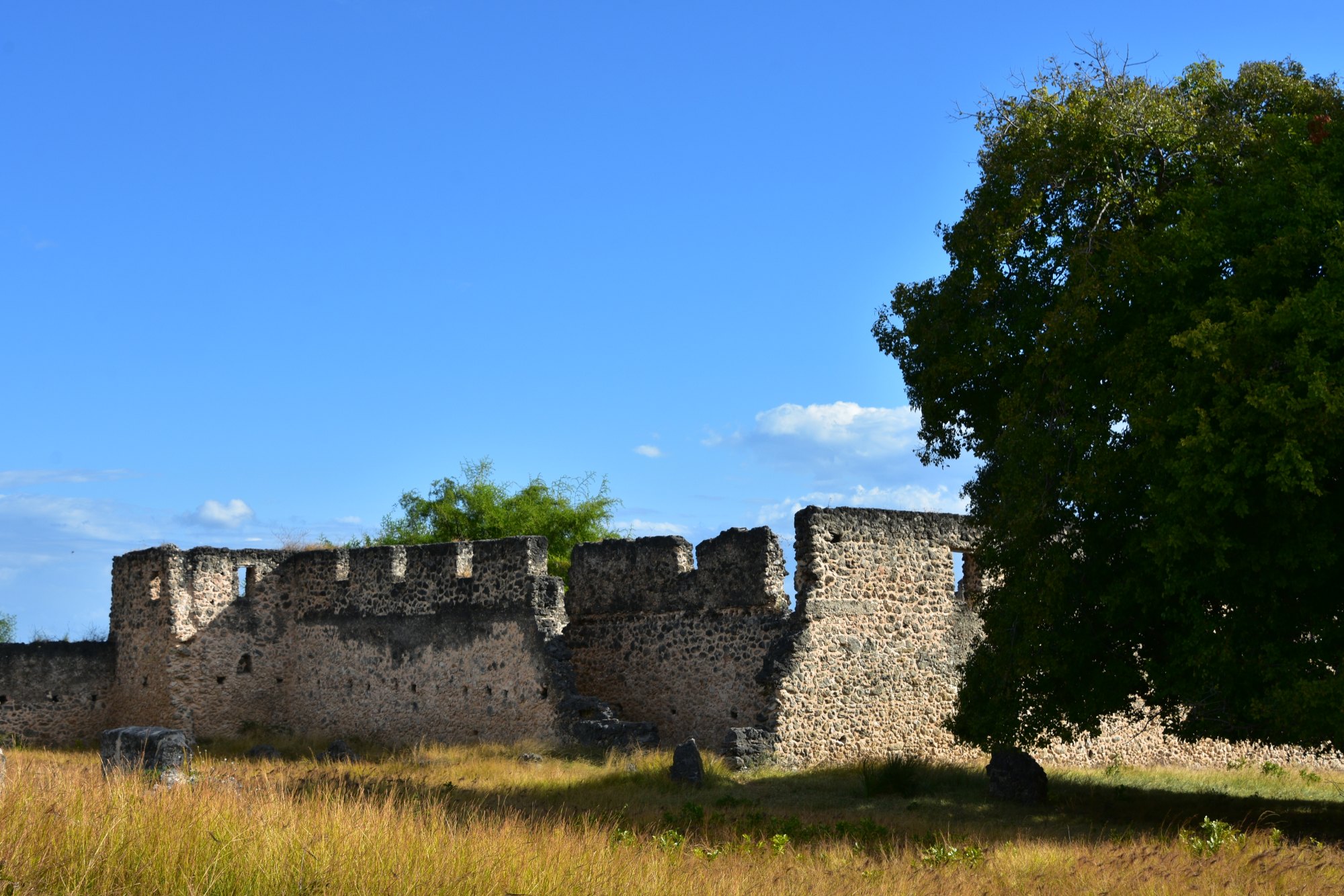
On Kilwa Kisiwani much of the city remains unexcavated beneath the vegetation. The standing remains are built of coral and lime mortar. The Great Mosque, begun in the eleventh century and considerably enlarged in the thirteenth, is the oldest standing mosque on the East African coast; UNESCO records that it is roofed entirely with domes and vaults across sixteen bays in a plan found nowhere else, some of them decorated with Chinese porcelain embedded in the fabric, and that its thirteenth-century dome was the largest in East Africa until the nineteenth. The palace of Husuni Kubwa, built between about 1310 and 1333, includes a large octagonal bathing pool. There is a second enclosure, Husuni Ndogo; numerous smaller mosques; the Gereza, constructed on the ruins of the Portuguese fort; and an entire urban complex of houses, public squares and burial grounds. At the northern end of Songo Mnara island stand the remains of five mosques, a palace complex and some thirty-three houses of coral stone and wood inside an enclosing wall.
Two associated sites are deliberately outside the inscribed boundary and are worth knowing about: Kilwa Kivinje, a mainly nineteenth-century trading town which the district council describes as once the German administrative centre for the region and now a fishing village; and Sanje ya Kati, an island south of Kilwa with ruins over some 400 acres, including houses and a mosque dating to the tenth century or earlier.
The property was placed on the List of World Heritage in Danger in 2004 and removed from it on 17 June 2014. The threats that put it there have not gone away — invading vegetation, inundation by the sea, encroachment by building and agriculture over buried archaeology, and increased wave action and beach erosion attributed to climate change. It is administered by the Antiquities Division, with a site manager and assistant conservators on the ground, which is still UNESCO’s own description of the arrangement. The 2025-2035 integrated management plan for the property was produced by the Tanzania Wildlife Management Authority, whose page UNESCO now also links, so responsibility appears to be shifting.
How a visit works
Visiting the islands means a permit from the antiquities office in Kilwa Masoko and a chartered boat with a guide, which the town’s hotels will normally arrange. The crossing is tide-dependent, so the day is built around the water rather than the clock — that single fact shapes everything about planning a Kilwa visit, and it is the reason a single rushed day here is usually a mistake. Kilwa Kisiwani and Songo Mnara are separate trips. The guide to archaeological tours covers the mechanics and what a good site guide should be able to tell you, and Swahili cultural tours covers the wider coastal story the ruins belong to.
The town and the water
Kilwa Masoko is an ordinary, relaxed Tanzanian coastal town with a busy market, and the district council presents it as exactly that rather than as a resort. Its own shoreline at Masoko Pwani is a coconut-lined beach. Offshore the reefs are barely dived, and the council lists rays, whale sharks and dolphins among what is seen out there — see scuba diving, snorkelling and dolphin watching. Fishing, either sport fishing or going out with a local crew, is a real option here: see deep-sea fishing.
Inland from the town run creeks and mangrove channels that the council says hold hippo, crocodile and dugong, and there are hippos in the Nyange River. Mangrove is extensive throughout the district — see mangrove tours and bird watching. Kilwa also falls inside the Rumaki biosphere reserve, which spans Rufiji, Mafia, Kibiti and Kilwa, and the conservation framing is covered under conservation tours.
Getting there and when to go
Kilwa is a long drive south from Dar es Salaam or a light-aircraft flight — see scenic flights. Either way it is a genuine expedition rather than a detour, and it deserves more than a day. The northern approach passes Nyerere National Park, which is the natural combination for anyone coming this far south. The guide to getting down Tanzania’s southern coast covers what that drive costs in hours and what a light-aircraft leg buys back.
The seasons here are not the same as on the northern coast, and this catches people out. The Tanzania Meteorological Authority places Lindi and Mtwara regions in the southern coastal zone, which is unimodal: one rainy season a year, beginning in November and ending between April and May. There is no separate October-to-December Vuli here, and no dry gap in January and February. The reliable window is therefore the long dry stretch from about June to October — which is also when the boat crossings are most predictable, since the Kilwa crossing is weather-dependent as well as tide-dependent. The guide to Tanzania’s two rainfall regimes sets out why the southern coast runs on one season and the northern coast on two.
Common questions
Are the ruins in Kilwa Masoko itself?
No. Kilwa Masoko is the mainland town. Kilwa Kisiwani is on an island across the channel and Songo Mnara is a separate island further south. Both need a boat, a guide and an antiquities permit obtained in the town.
How far is Kilwa from Dar es Salaam?
Sources differ slightly according to what is being measured. UNESCO places the two island sites about 300 kilometres south of Dar es Salaam; Kilwa District Council gives Kilwa Masoko as around 330 kilometres south. The road journey is long in either case.
How many days do you need?
Two full days on the ground is a sensible minimum, so that Kilwa Kisiwani and Songo Mnara can be taken as separate trips and the tides can be worked around. Three lets you add the reefs or Kilwa Kivinje without compressing anything.
Is the site still on the World Heritage in Danger list?
No. It was inscribed on the Danger list in 2004 and removed on 17 June 2014. The underlying pressures — vegetation, sea inundation, erosion and encroachment on buried archaeology — remain live conservation concerns.
What is Kilwa Kivinje?
A separate, mainly nineteenth-century trading town on the mainland north of Masoko, which the district council describes as formerly the German administrative centre for the region and now a fishing village. It lies outside the inscribed World Heritage boundary and has a distinct, much later character from the island ruins.