Africa’s largest lake, and Tanzania’s southern half of it
Lake Victoria is the largest lake in Africa and the principal reservoir of the Nile. The Tanzanian government’s own 2024 submission to UNESCO’s tentative list gives its area as 69,484 square kilometres and describes it as the largest of its kind on the continent and the main reservoir for the Nile. Tanzania holds the southern portion; Uganda and Kenya hold the north and north-east.
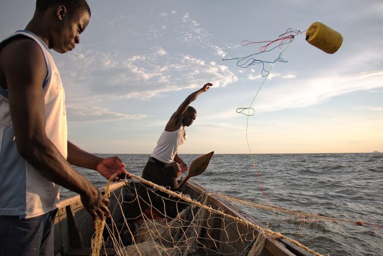
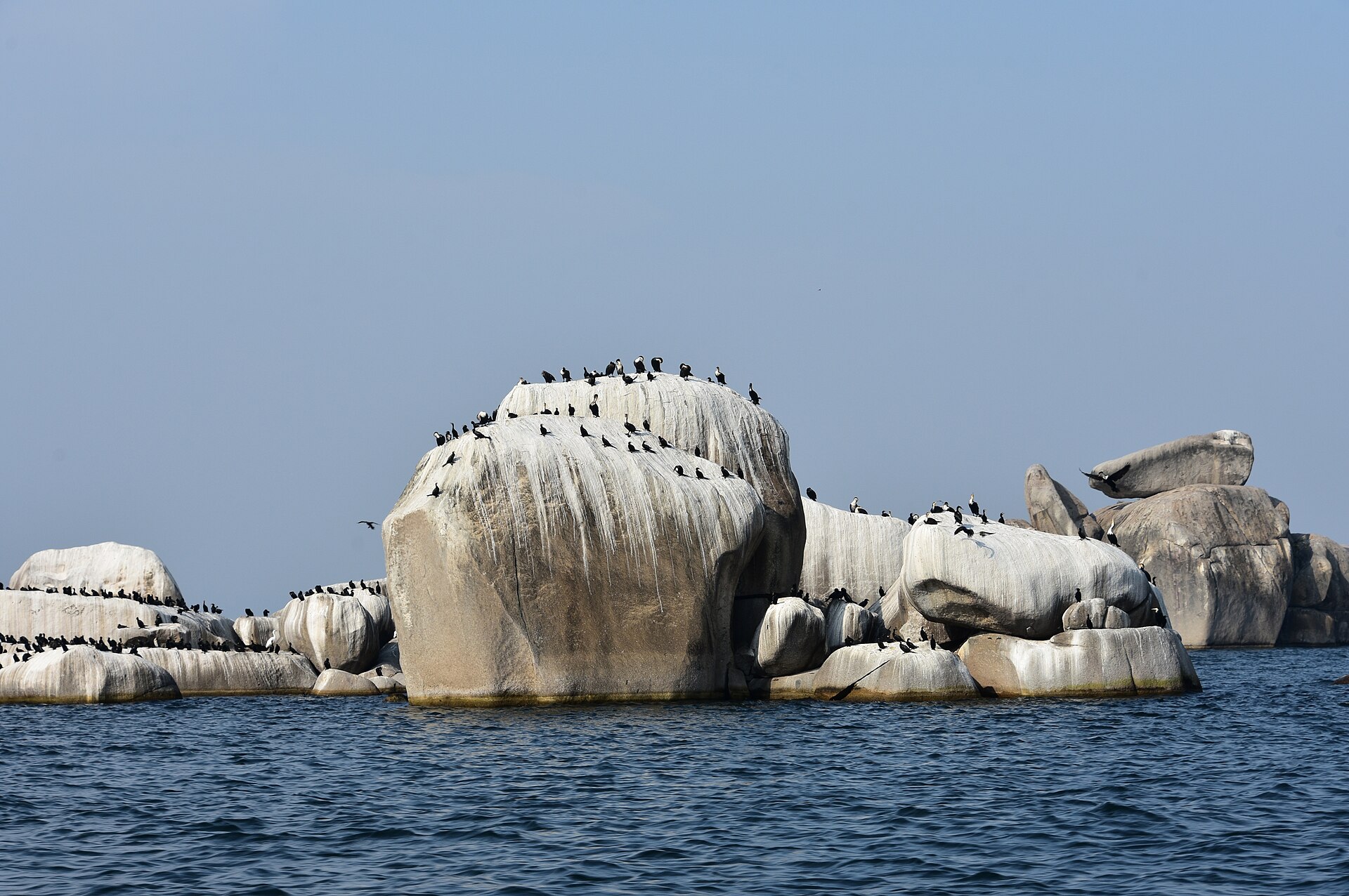
This is not safari country and it does not pretend to be. The lake’s Tanzanian shore is a working landscape of ports, fishing villages, granite outcrops and ferry routes, with two small island national parks and a great deal of ordinary daily life. Travellers arriving from the Serengeti a few hours east often find the change of register more interesting than another game drive.
The Tanzanian lake towns
Mwanza is the centre of gravity: Tanzania’s second city, on the southern shore, built among granite boulders and known as Rock City. It has the airport, the ferries, the fish market and the only national park inside a Tanzanian city. Bukoba sits on the western shore in Haya country, in coffee and banana country below an escarpment. Musoma occupies a peninsula on the eastern side, north of the Serengeti’s western corridor and near Butiama, where Julius Nyerere was born and is buried. Chato, on the south-western shore in Geita Region, has an airport and sits beside Burigi-Chato National Park.
The two island national parks
Rubondo Island National Park lies in the south-west of the lake and covers 456.8 square kilometres according to TANAPA. It was set up as a game reserve in 1965 and became a national park in 1977. Dense remnant lowland rainforest, papyrus swamp holding sitatunga, a very long bird list and one of the highest fish eagle densities anywhere make it the more substantial of the two by a distance, and it also holds a chimpanzee population descended from animals introduced from European captivity in the 1960s.
Saanane Island National Park is the opposite proposition: 2.18 square kilometres of granite and scrub a ten to fifteen minute boat ride from Mwanza city centre, gazetted as a national park in 2013. It is a half-day rather than a destination, and it is honest about that.
What there is to do
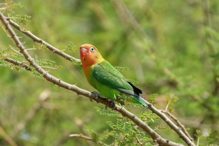
The lake’s activities are mostly water-based and mostly small-scale. Boat safaris along the Rubondo shoreline and through the papyrus are a headline activity in their own right at that park. Bird watching is strong everywhere on the lake — Rubondo alone carries Afrotropical and Eurasian migrants, an introduced African grey parrot population and abundant fish eagles.
Nile perch fishing on Lake Victoria is a recognised product, and TANAPA describes it at Rubondo as catch-and-release; see the freshwater fishing guide. Kayaking and lake paddling are covered in the kayaking guide. Ferry travel between the lake ports is a genuine way to see the place and is dealt with in the rail and ferry journeys guide. The guide to reaching the lake and moving on from it puts those crossings alongside the flights and roads most itineraries use.
On land, village tours and market tours are the natural fit for lake towns where fishing employs most of the population — Musoma District Council puts the figure at around 85 per cent for its own area.
Rock art around the lake
One of the least-publicised things about the Tanzanian lake shore is its rock art. In February 2024 Tanzania, Kenya and Uganda jointly submitted “Geometric rock art in Lake Victoria Region” to UNESCO’s tentative list as a transnational serial nomination. The Tanzanian component alone comprises 46 sites: four at Bukoba, nine more in Bukoba District, 24 at Muleba, two at Mwanza and seven at Musoma. All are on granite outcrops.
The images are large red geometric finger-paintings. Dating work carried out at two of the Ugandan sites in the same tradition puts the paintings between roughly 1,000 and 5,000 years old. The submission notes that East African rock art has attracted far less attention than the fine-line traditions of southern Africa, and that Kondoa is currently the region’s only inscribed rock-art landscape.
This is a nomination on a tentative list, not an inscribed World Heritage site, and most of the 46 sites have no visitor infrastructure whatsoever. It is included here because it is verifiable, unusual and almost entirely absent from what is written about the lake. Anyone interested in the wider subject should read the archaeological tours guide.
Bilharzia in Lake Victoria
The risk on Lake Victoria is real and better documented than on most African lakes, and it is worth stating plainly.
The clearest published example is a 2011 report in the Journal of Travel Medicine by Chunge and colleagues, describing 77 people from Nairobi who had taken a church retreat to Mwanza in 2008. Sixty-six of the 77 were diagnosed with acute Schistosoma mansoni infection. The paper also records unusual ocular symptoms as a rare presentation. Its own conclusion is that the outbreak highlights the risk of swimming in Lake Victoria.
Sixty-six out of 77 is not a marginal attack rate. The United States Centers for Disease Control and Prevention names only the sea and adequately chlorinated swimming pools as safe for swimming in countries where schistosomiasis occurs; it does not rank lakes and it publishes no safe depth or distance from shore. Boat trips, fishing and shoreline walking carry no equivalent risk — it is contact with the water that matters. The same discussion applies to Lake Tanganyika, where the documented figures are lower but the principle is identical.
Seasons
The Lake Victoria basin is one of Tanzania’s bimodal zones. The Tanzania Meteorological Authority defines its Lake Victoria zone as the Kagera, Geita, Mwanza, Shinyanga, Simiyu and Mara regions, together with the Kakonko and Kibondo districts of northern Kigoma. These areas receive two rainy seasons a year: Vuli, which TMA places from October to December, and Masika from March to May.
That October start matters and is frequently reported wrongly as November. Musoma District Council independently describes its own short rains as October to December and its long rains as March to May, with annual rainfall of 900 to 1,200 millimetres. Missenyi District on the western shore reports higher totals near the lake, between 1,400 and 2,000 millimetres a year, falling away inland. The national rainfall calendar sets the lake basin’s two seasons against the single season most of the country runs on.
Common questions about Lake Victoria
How big is Lake Victoria?
Tanzania’s 2024 UNESCO tentative list submission gives 69,484 square kilometres and describes it as the largest lake of its kind in Africa and the main reservoir of the Nile.
Can you swim in Lake Victoria?
Bilharzia is a well-documented risk. A 2011 Journal of Travel Medicine report found 66 of 77 visitors infected with Schistosoma mansoni after a retreat at Mwanza. The CDC names only the sea and chlorinated pools as safe in endemic countries. Boating, fishing and shoreline walking are a different matter; it is water contact that carries the risk.
Which national parks are on the Tanzanian side?
Rubondo Island, a forested island park of 456.8 square kilometres in the south-west, and Saanane Island, 2.18 square kilometres within sight of Mwanza. Burigi-Chato lies inland from the western shore.
Is Lake Victoria worth adding to a safari?
It is worth it if you want the contrast: ports, markets, ferries, fishing villages and rock outcrops rather than plains game. It is not worth it as more of the same. Mwanza is the easiest entry point and connects to the western Serengeti.
When do the rains fall on the lake?
Two seasons: Vuli from October to December and Masika from March to May, per the Tanzania Meteorological Authority, which classifies the Kagera, Geita, Mwanza, Shinyanga, Simiyu and Mara regions as its Lake Victoria zone.
Is there rock art you can actually visit?
Forty-six Tanzanian sites form part of a transnational nomination submitted to UNESCO’s tentative list in 2024, concentrated around Bukoba, Muleba, Mwanza and Musoma. It is a tentative-list nomination rather than an inscribed site, and most of the sites have no visitor infrastructure. Treat it as a reason to ask locally rather than a ready-made excursion.