
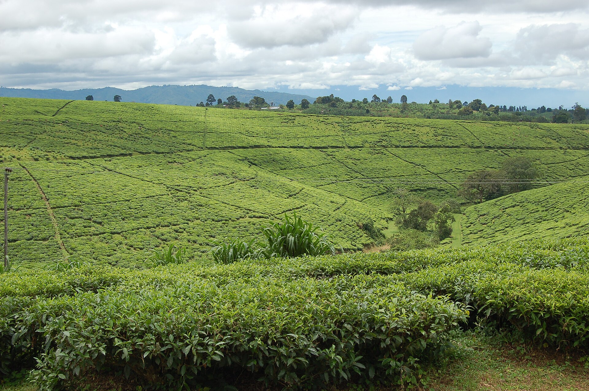
A small town in the wettest country in Tanzania
Tukuyu is the main town of Rungwe District, sitting on the southern slopes of Mount Rungwe between Mbeya and Lake Nyasa. It is small, green, wet and cold, and it is the natural base for the best walking country in the Southern Highlands.
The rain is the defining fact. This is among the wettest parts of the country, and the consequence is visible in every direction: banana stands, tea, cocoa and coffee growing together, forest on the volcanic slopes, and rivers that run hard all year. Rungwe District Council records the district at 123,186 hectares, of which 92,389.5 are suitable for agriculture, and names coffee, tea, cocoa, bananas, maize, potatoes, sweet potatoes, beans and rice as its main crops.
The council also gives a detail that says more about the district than any scenery description: 33,585 improved dairy cattle producing 62,903,325 litres of milk a year, of which around eleven per cent is sold. Dairy at this scale in Tanzania is a highland phenomenon, and the reason is exactly the cold, wet, well-watered conditions that make Tukuyu what it is.
What is around it
Mount Rungwe. The stratovolcano above the town, managed by Tanzania Forest Services within the Lake Ngozi Nature Forest Reserve. TFS gives its altitude as 2,981 metres and calls it the highest peak in the Southern Highlands; the Smithsonian Institution’s Global Volcanism Program gives 2,953 metres and dates its last known eruption to around 1250. Both figures are authoritative and both are given here. The massif is one of only two places in Tanzania that hold the kipunji, the monkey described in 2004 in a new genus.
Lake Ngozi. A caldera lake on the same massif, reached on a forest climb to the rim, with its own guide at Lake Ngozi Nature Forest Reserve.
Kaporogwe Falls. The distinctive waterfall of the region, falling from a lava ledge that you can walk behind, with the Livingstone Mountains behind it. No authoritative height is published for it, so none is given.
God’s Bridge. Known locally as Daraja la Mungu, a natural rock bridge over the Kiwira river formed by a lava flow, with the pothole formations at Kijungu nearby. It is the best-known geological curiosity in the district.
Kisiba crater lake and the Malasusa falls complete the list of sites Tanzania Forest Services names around its Rungwe reserve.
Tea
Tukuyu is tea country, and the country’s tea history starts near here. The first experimental plantings in Tanzania were made in 1904, at the research station at Amani in the Usambaras and at Rungwe in the south-west, with the early work associated with Kyimbila. Tanzanian tea is grown in three main areas, and the Rungwe and Tukuyu country is the third of them, alongside the Usambaras and the Mufindi and Njombe highlands.
Estates and factories in the district are named repeatedly in travel writing as places to visit. What a visit actually delivers — and what to ask before arranging one — is covered in the tea plantation tours guide.
Getting there
Tukuyu is on the road from Mbeya down to Kyela and the Lake Nyasa shore, which makes it a stop on the way to Matema rather than a destination people set out for. Mbeya is the nearest town with an airport, a railway station and a trunk road, and the guide to how far each of Tanzania’s networks reaches covers what each of those actually offers; Tanzania Forest Services lists accommodation for the Rungwe reserve as available at Tukuyu township and in Mbeya city.
When to go
This is unimodal country: one rainy season from November into April or May, wetter in its second half. Given how much rain falls here in an average year, the dry months from June to October are the obvious window for walking Rungwe and Ngozi and for the escarpment road down to the lake. Cloud sits on the high ground regularly whatever the season, so a clear summit view is never guaranteed. The guide to Tanzania’s rainfall and seasons covers how the wettest corner of the country differs from the safari circuits.
Where it fits in a trip
Tukuyu is the middle of the Southern Highlands loop: Mbeya for Ngozi and Rungwe, Tukuyu for the tea, the bridge and the waterfalls, then down to Matema and the lake. Two nights here is enough to walk one of the big features and see two or three of the smaller ones.
It also makes a reasonable alternative base to Mbeya for anyone who would rather be in the country than in a city, at the cost of a longer drive to Kitulo.
Common questions
Is Tukuyu worth a night?
Yes, if you are doing the Southern Highlands loop. It puts Rungwe, Ngozi, Kaporogwe and God’s Bridge within short drives and shortens the run down to Lake Nyasa.
How high is Mount Rungwe?
Tanzania Forest Services, the managing authority, gives 2,981 metres. The Smithsonian Global Volcanism Program gives 2,953 metres. Both are given here rather than averaged.
Can you see the kipunji?
The Rungwe massif is one of only two places it occurs in Tanzania, but it lives high in the forest canopy and is difficult even for researchers. Treat any sighting as luck rather than as a plan.
Can you visit a tea estate?
Estates and factories in the district are regularly named as visitable, but arrangements here are made locally and informally rather than booked ahead. Ask in Tukuyu.