
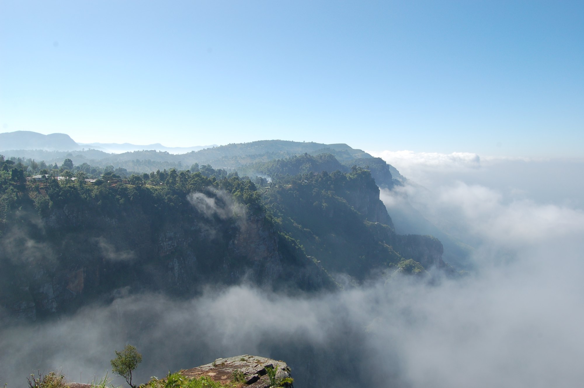
What the Usambaras are
The Usambaras are two forested massifs rising out of the plains of north-eastern Tanzania, in Tanga Region, and they belong to a much older world than the mountains people come to Tanzania for. They are part of the Eastern Arc, a chain of ancient crystalline blocks running in a broad curve through eastern Tanzania and into Kenya. The Eastern Arc Mountains Conservation Endowment Fund describes thirteen separate blocks spread along roughly 600 kilometres of arc, twelve of them in Tanzania across fifteen districts, and puts the age of their forests at over thirty million years — forests that were once continuous with those of the Congo Basin and West Africa. For comparison, the fund gives Kilimanjaro as one to two million years old.
That age is the whole point. Long isolation on wet, stable mountain islands surrounded by dry plains has produced a concentration of species found nowhere else: the fund counts at least a hundred endemic birds, mammals, amphibians and reptiles and more than five hundred endemic plants across the Eastern Arc, and reckons around forty per cent of Tanzania’s remaining tropical high forest sits in these blocks. The Usambaras are among the richest of them.
For a traveller, this is a completely different proposition from the rest of the northern circuit. There is no big game to speak of. What there is, is forest, farmland, footpaths, escarpment views and a great many things that live nowhere else on earth.
Two ranges, not one
“The Usambaras” covers two blocks separated by the Lwengera valley, and they are visited in different ways for different reasons.
The West Usambaras
Higher, cooler, much more heavily settled, and the half most people mean. The plateau is a densely populated landscape of villages, terraced vegetable plots and forest remnants, linked by footpaths that have been the local transport network for generations. Lushoto is the base; Bumbuli and Korogwe districts hold the southern end.
The managed forest above Lushoto is Magamba Nature Forest Reserve, which Tanzania Forest Services gives as 9,283.9 hectares across Lushoto and Korogwe districts. Its high point, Kwahondo Peak at 2,287 metres, is the highest point in the Usambaras.
It is worth knowing what has happened here. The West Usambara forest block is thought to have covered around 2,300 square kilometres historically; by 2000 roughly 323 square kilometres remained. The farmland is as much the story as the forest is, and pretending otherwise misrepresents the place.
The East Usambaras
Lower, wetter, far less settled, and the half that matters most biologically. This is submontane rainforest on the seaward side of the range, catching moisture off the Indian Ocean, and it holds the single most important protected block in the Usambaras: Amani Nature Forest Reserve, 8,380 hectares in Muheza and Korogwe districts, declared in 1997 out of six older forest reserves. Nilo Nature Forest Reserve lies to the north of it.
The East Usambaras are also tea country, and the tea and the forest are formally entangled: the 1997 order that created Amani took in 1,065 hectares covenanted to the Chief Conservator by the East Usambara Tea Company and Karimjee Agricultural Limited for nature conservation. The estates you drive through on the way up are part of the reserve’s boundary story rather than an intrusion on it.
If you have come for birds, butterflies, amphibians or plants, the East Usambaras are where you go. If you have come to walk between villages in cool air with a view, the West Usambaras are.
Getting into them
Both halves are reached off the Dar es Salaam–Arusha highway where it crosses the plains east of the range. For the West Usambaras the road leaves the highway at Mombo and climbs the escarpment through Soni to Lushoto; Tanzania Forest Services gives Lushoto as about 340 kilometres from Dar es Salaam and about 310 kilometres from Kilimanjaro. For the East Usambaras the approach is from Muheza, with Amani about 18 kilometres north-west of the township.
The Usambaras sit roughly between the northern circuit and the coast, which is the reason they work so well as a stop. A trip that ends at Moshi or Mkomazi and continues to Tanga or Pangani passes the foot of the range anyway — which makes the Usambaras one of the cheapest additions in days to a northern itinerary, a calculation the guide to how many days the country really needs works through.
What there is to do
- Village-to-village walking in the West Usambaras, two to five days at 1,500 to 2,000 metres, sleeping in villages rather than under canvas. The gentlest multi-day walking in Tanzania; see the mountain trekking guide.
- Escarpment viewpoints — Irente above the drop to the Maasai plain, Mambo further north looking towards Kenya. Half-day outings from Lushoto; see the day hiking guide.
- Forest walking in Magamba and, more rewardingly, in Amani, where the trail network exists for the forest rather than for the view. See the forest walk guide.
- Birding. This is the serious reason to come. Endemism is the draw and the East Usambaras are the place; see the bird watching guide.
- Waterfalls around Soni and Kisasa, covered in the waterfall hiking guide.
- Tea and farms. The estates of the East Usambaras and the vegetable smallholdings of the West are both worth a day; see the tea plantation tours guide and the farm tours guide.
- Cycling on the ridge roads; see the mountain biking guide.
- Village visits and the Sambaa country the walking passes through; see the village tours guide.
- Conservation visits. The Eastern Arc is one of the few places in Tanzania where the conservation story is genuinely legible on the ground; see the conservation tours guide.
When to come
The Usambaras are in the bimodal zone, with Vuli from October to December and Masika from March to May on the Tanzania Meteorological Authority’s definitions. The range is wet by design — it is what has kept the forest alive — and the East Usambaras in particular hold moisture through much of the year.
Temperature is the thing people get wrong. The Usambaras and the Southern Highlands make their own weather, and a forecast for the coast tells you nothing about the plateau. Cold, cloud and fine rain are normal at altitude here in any month, which is why the country’s season-by-season guide treats the Eastern Arc ranges separately from the plains.
Common questions about the Usambara Mountains
What is the difference between the East and West Usambaras?
The West Usambaras are higher, cooler, heavily farmed, and are where the village walking and the escarpment viewpoints are, based on Lushoto. The East Usambaras are lower, wetter, far less settled, hold the more important surviving rainforest at Amani, and are where birders and botanists go. They are separate blocks, reached by different roads.
What is the Eastern Arc?
A chain of ancient crystalline mountain blocks running through eastern Tanzania into Kenya — thirteen blocks over roughly 600 kilometres, twelve of them in Tanzania. Their forests have persisted for over thirty million years, which is why so much of what lives in them lives nowhere else.
Is there big game in the Usambaras?
No. This is a farmed and forested landscape, not a savanna park. The significance is in plants, birds, amphibians, reptiles and invertebrates, and the visitor experience is walking rather than game viewing.
What is the highest point?
Kwahondo Peak, at 2,287 metres, inside Magamba Nature Forest Reserve above Lushoto. It is reached on a named trail rather than as an expedition.
How do the Usambaras fit into a Tanzania itinerary?
Usually as a break between the northern circuit and the coast, since the range sits between the two. They also stand alone for walkers and birders who are not doing a safari at all.
How much forest is left?
Less than most visitors assume. The West Usambara forest block is thought to have covered around 2,300 square kilometres historically, with roughly 323 square kilometres remaining by 2000. The protected blocks — Magamba, Amani, Nilo — are remnants within a farmed landscape rather than a continuous forest.