
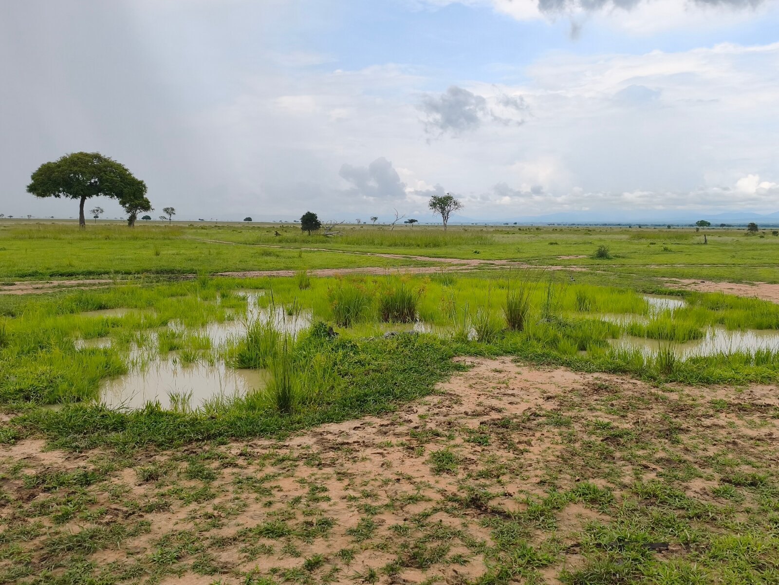
Almost every page answering this question tells you Tanzania has two rainy seasons — long rains from March to May, short rains in November — and one dry season from June to October. That is a description of about a third of the country. The Tanzania Meteorological Authority recognises two different rainfall regimes with different calendars, and the boundary between them runs straight through the middle of a typical two-week itinerary. Getting this right changes which month you book, which circuit you build, and whether the second half of your trip is in the season you planned for.
The short answer, and the part of it that is usually wrong
If your trip is the northern circuit — Serengeti, Ngorongoro, Tarangire, Lake Manyara, Kilimanjaro — plus Zanzibar, then the familiar advice is broadly right. Those places are in the bimodal zone. They get two wet seasons and two dry ones, and the long dry window is June to September — not June to October, because the short rains begin in October, which is where a lot of itineraries get caught.
If your trip runs south or west — Ruaha, Nyerere, Katavi, Mahale, the Southern Highlands, Kilwa — then it is wrong in a way that matters. Those places have one wet season, and it runs from November through to April or May in a continuous block. There is no dry gap in January and February to slip a trip into. There is no separate “short rains”. And the back half of that season can be the wetter one — TMA forecast exactly that for 2025/26 — so February to April, not November, is the window to check hardest in the south.
A trip that puts the Serengeti and Ruaha in the same fortnight is crossing a climatic boundary, not just a driving distance. That is the single most useful thing on this page.
Tanzania’s two rainfall regimes, as the meteorological authority defines them
The Tanzania Meteorological Authority (TMA) sets this out in its annual Statement on the Status of Tanzania Climate. The mechanism is the Inter-Tropical Convergence Zone — a belt of rainfall that migrates south across the country late in the year and back north in the first half of the next. Places the belt crosses twice get two rainy seasons. Places at the southern end of its travel, where it turns around, get one long one.
TMA’s own wording, from the 2025 statement: “Regions that experience a single passage follow a unimodal rainfall regime, receiving rainfall from November to April or May in the subsequent year (also known as Msimu)… Areas with double passages experience a bimodal rainfall regime, with two distinct rainy seasons: the long rains (Masika), which typically begin in March and continue through May (MAM), and the short rains (Vuli), which start in October and last through December (OND).” It adds: “January and February are relatively dry for areas with a bimodal rainfall regime, while June through September are dry months for the entire country.”
The bimodal zone: two wet seasons, two dry ones
TMA names four bimodal areas in its seasonal outlooks:
- North-eastern highlands — Arusha, Manyara and Kilimanjaro regions.
- Northern coast and its hinterland — northern Morogoro, Pwani including Mafia Island, Dar es Salaam, Tanga, and the islands of Unguja and Pemba.
- Lake Victoria basin — Kagera, Geita, Mwanza, Shinyanga, Simiyu and Mara.
- Northern Kigoma — specifically the districts of Kakonko and Kibondo.
Its calendar, therefore:
| Period | What it is |
|---|---|
| October to December | Vuli, the short rains. Onset moves from the Lake Victoria basin south-east over several weeks, reaching the northern coast and the north-eastern highlands last. TMA forecast their onset for the first and second week of October in 2026, and for the first and second week of November in 2025. |
| January to February | The dry gap between the two seasons. TMA: “relatively dry”. |
| March to May | Masika, the long rains. April is normally the wettest month. |
| June to September | The long dry season, and also the cool season. |
Vuli starts in October, not November. This is where the tourism shorthand is most often wrong. TMA’s seasonal product for this year is titled “CLIMATE OUTLOOK FOR VULI RAINFALL SEASON OCTOBER – DECEMBER, 2026”, and the climate statement quoted above abbreviates the season OND. An itinerary pitched as “just before the short rains” and dated mid-October is not before them. The forecast onset date for the coast and the north-eastern highlands does move, though, and by more than a month: TMA put it in the first and second week of November for 2025, and in the first and second week of October for 2026. The season boundary is the thing to plan the shape of a trip around; the start date in any particular year is worth reading off that year’s outlook rather than assuming.
The unimodal zone: one long season, back-loaded
TMA’s unimodal areas, from the Msimu outlook: “western, central, southwestern highlands, southern, southern coast, and southern part of Morogoro region”. Named by region: southern Kigoma, Tabora, Katavi, Singida, Dodoma, Njombe, Iringa, Mbeya, Songwe, Rukwa, Ruvuma, Mtwara, Lindi, and southern Morogoro.
The season is called Msimu and runs November to April or May. Two details change how a trip should be planned around it.
First, January is inside the rains, not a break in them. That part is structural: Msimu runs from November to April or May in one block, and the “relatively dry” January and February of TMA’s own definition belong to the bimodal zone. Whether the back half of a given season is the wetter half is a forecast rather than a fixed property, and TMA forecast exactly that shape for 2025/26: “The second half of the season (February-April, 2026) is expected to be relatively wetter than the first half (November, 2025 – January, 2026).” It is the question to put to an operator about your own year. Either way, a traveller who has internalised “January is a good month in Tanzania” is carrying a northern-circuit fact into the south, where January sits inside the rains.
Second, the dry season is longer: roughly May to October, against June to September in the north. TMA’s 2025/26 outlook has the rains ceasing in “the fourth week of April and first week of May” and recommencing in the third or fourth week of October in the west, or the second and third week of November in the south-western highlands. So the southern and western parks have a broader dry window than the northern circuit, and it opens earlier.
Which regime your destinations are in
This is the table to check before you fix dates.
| Regime | Destinations |
|---|---|
| Bimodal — Vuli Oct–Dec, dry Jan–Feb, Masika Mar–May, dry Jun–Sep | Serengeti, Ngorongoro, Tarangire, Lake Manyara, Arusha NP, Kilimanjaro, Mount Meru, Mkomazi, Lake Natron, Lake Eyasi, Arusha, Moshi, Karatu, Usambara and Pare Mountains, Tanga, Saadani, Bagamoyo, Pangani, Dar es Salaam, Zanzibar, Pemba, Mafia, Mwanza, Musoma, Bukoba, Rubondo Island, Saanane Island, Burigi-Chato |
| Unimodal — Msimu Nov–Apr/May, wetter Feb–Apr, dry May–Oct | Ruaha, Nyerere, Udzungwa Mountains, Kitulo, Katavi, Mahale Mountains, Gombe, Lake Tanganyika, Kigoma, Tabora, Iringa, Mbeya, Njombe, Songea, Tukuyu, Matema, Lake Nyasa, Lake Rukwa, Southern Highlands, Uluguru Mountains, Dodoma, Kondoa, Kilwa Masoko, Mikindani, Mnazi Bay |
Three boundary cases are worth naming rather than smoothing over.
Morogoro Region is split — TMA puts the north of it in the bimodal northern coast zone and the south in the unimodal south-western highlands zone. Mikumi sits close to that line. TANAPA’s own description of the park is unimodal in shape: “Mikumi’s dry season lasts between May and November”.
Kigoma Region is split by district. TMA names Kakonko and Kibondo, in the far north, as bimodal; the Msimu outlook names “southern Kigoma” as unimodal. Gombe, Mahale and Kigoma town all lie south of those two districts, which places them in the unimodal western zone.
The coast is not one thing. Mafia Island is in Pwani Region and is bimodal; Kilwa, a few hours further down the same coastline in Lindi Region, is unimodal. Two beach destinations on the same ocean, on different calendars.
Temperature, and what altitude does to it
Tanzania’s temperature varies less through the year than its rainfall, and far more with altitude than with month. TMA’s 2025 statement gives a national annual average across stations of 14.7 °C to 27.5 °C, with mean daily minima from 9.9 °C to 24 °C and maxima from 19.5 °C to 31.2 °C, and notes that the hottest places are “along the coast and in the western parts of the country”.
The seasonal shape is straightforward: “The season with high temperatures starts in October and continues through February or March, while the cool season is from May to August.”
That cool season is the part travellers underpack for. It overlaps the national dry season across June, July and August, which is exactly when most safaris happen. TMA’s forecast ranges for September 2026 give a sense of the spread: minima of 18–26 °C on the coastal strip and islands, 13–20 °C in the north-eastern highlands with high ground falling below 13 °C, 12–20 °C in the central regions, and 8–18 °C in the south-western highlands with parts of Njombe below 8 °C. The lowest daily minimum TMA recorded anywhere in 2025 was 4.2 °C, at Igeri in the southern highlands on 5 August.
Practically: a game drive leaving camp at six in the morning in the Serengeti in July is cold, an open-sided vehicle makes it colder, and the crater rim at Ngorongoro is colder again. The heat you were expecting arrives around ten.
The Serengeti migration, and what can honestly be said about when
The wildebeest migration is the reason a great many people choose a month, so it deserves a straight answer about how reliable a month can be. The answer is unusual: the calving window is tight and well documented, and the river crossings are not.
What the herd is, and how big
Four authorities give four different numbers, which is worth knowing before anyone quotes one at you.
| Figure | Source | What kind of figure |
|---|---|---|
| 1,366,109 ± 231,741 (standard error) | Tanzania Wildlife Research Institute, Aerial Wildebeest Survey in the Greater Serengeti Ecosystem, Wet Season 2023 | The government census, flown 28–31 March 2023; the 25th in the series |
| “over 1.5 million” | TANAPA | Authority, promotional copy |
| “two million wildebeests” | UNESCO World Heritage Centre, site 156 | Inscription text |
| 502,917–533,137 detected, August 2023 | Duporge and colleagues, PNAS Nexus, 2025 — AI-based satellite survey, corrected December 2025 | Not a population estimate. A count of animals visible in the area surveyed. The authors’ correction states that extrapolation to the whole population “is not justified, and no inference can be made about the accuracy of previous estimates” |
The census figure is the one to use. The satellite study is not a rival total but a different instrument pointed at part of the same ground, and in December 2025 its authors published a correction making that explicit — the count covers only what was visible inside the surveyed area, and no inference about the census follows from it. Read as a call for the two methods to be flown against each other, which is how the authors put it, it is useful; read as a population figure, it is being asked to do something it cannot. But “1.5 million” and “two million” are promotional and inscription language, not counts.
Why the herd moves
Not “following the rains”, quite. The published explanation is two gradients pulling in opposite directions. Holdo and colleagues put it directly in PLoS ONE in 2011: the migration “is driven by two abiotic gradients: a seasonal rainfall gradient that increases from the Serengeti plains in the southeastern portion of the ecosystem towards the northwestern woodlands near Lake Victoria, and an opposing gradient of increasing soil fertility.”
The short-grass plains of the south-east sit on volcanic ash soils. They are mineral-rich and they are also seasonal — Holdo’s group describe them as unsuitable for year-round occupancy but “a vital source of low-fibre/high-protein grass during the wet season”. McNaughton showed in Nature in 1990 that the movements track grass mineral content, calcium and phosphorus among them, which matters most to lactating females. The northern woodlands, poorer but wetter, are what the paper calls “a refuge of last resort” at the end of the dry season.
Practically: the herd is in the south-east in the wet months, works north and west as the plains dry, and comes back when the rain returns. GPS collar work published by Torney and colleagues in 2018 puts the round trip at over 1,500 km, with females averaging about 4.5 km a day.
Calving: the one part of the year that is genuinely predictable
Wildebeest calving is extraordinarily synchronised, and the synchrony has been measured. Calabrese and colleagues, in Scientific Reports in 2018, report that 80 per cent of calves arrived within roughly 20 to 29 days, depending on the year. The synchrony is an anti-predator strategy — swamping and confusing the predators rather than avoiding them.
On the month, the sources agree: Torney and colleagues say “calving season in February coincides with this period of peak primary production”, and TANAPA’s own best-time note gives “January-February for calving season”. The place is the short-grass plains of the south-east, which is the Ndutu area and the southern Serengeti plains.
So a February trip to the southern plains is the most reliably timed wildlife event in Tanzania. What the published figures do not pin down is the start date. Calabrese’s synchrony metric, T80, is the length of the shortest window containing 80 per cent of the births — 19.56 days in 1973 against 28.99 days in 1965 — so the nine days between those two years measure how tightly the calving was packed, not when it began. The paper reports how wide the window was, not when it opened.
River crossings: what the numbers actually say
Here the picture reverses, and it is worth being blunt about it.
Subalusky and colleagues, publishing in PNAS in 2017, analysed fifteen years of Mara River data. Their finding: the herd arrived in the Mara River region “between early June and late July” and stayed “until November or December”, for 172 ± 45 days, and river crossings occurred on 52 ± 16 days per year. One caveat matters here and is easy to lose: the paper says repeatedly that its record — lodge and Mara Conservancy reports from 2001 to 2010, field surveys from 2011 to 2015 — covers “the Kenyan portion of the Mara River”, and its study reach ends at the Kenya-Tanzania border. The twelve major crossing sites it maps are on the Kenyan side. These are the best published timings there are, but they were counted in the Maasai Mara, not in the Serengeti. An arrival window spanning roughly seven or eight weeks between years is not something a fortnight’s holiday can be aimed at with confidence from either side of the border.
It gets less predictable, not more. Boone and colleagues, modelling herd distribution in Ecology in 2006, found their model matched observed densities reasonably in the dry and early wet season and essentially no better than chance in the late wet season. And Duporge’s 2025 satellite work offers, as one candidate explanation for why its count came in low, the possibility that the herd is spreading out beyond the mapped routes: “Behavioral plasticity in the selection of migration routes may be causing wildebeest to disperse more thinly across a much broader territory than previously documented, with wildebeest no longer crossing the Mara River into Kenya.” That sentence sits under the paper’s own heading of “An alternative explanation is an incomplete understanding of migration patterns”, it is hedged from beginning to end, and the correction published in December 2025 deleted the GPS-collar sentences that had been the only tracking evidence offered for it. It is a hypothesis about a satellite count, not a record that the crossings stopped. The paper separately observes that “unusual dry-season rains and postburn regrowth in the western and central ecosystem can alter wildebeest movements” — a different point, not the cause of the route change. What can fairly be drawn from all of this is narrower and still useful: the single most-marketed event on the Tanzanian safari calendar is less schedulable than it is sold as.
For the Grumeti River, no authority and no peer-reviewed source gives a timing at all.
What any authority actually publishes
No Tanzanian authority publishes a month-by-month map of where the herd will be. Not TANAPA, not TAWIRI’s census, not UNESCO. TANAPA’s own two statements do not even agree with each other: its general brochure says “The Serengeti is a year-round destination with access to all parts throughout the year”, while its Serengeti page offers a single line — “Best Time to Visit June-October (dry season) for migration; January-February for calving season.” On the question this section is asking — when the herd will be where — that line is the whole of the official guidance.
Every month-by-month migration calendar you will see elsewhere is therefore an interpolation from typical years, presented as a schedule. It is often approximately right. It is sometimes badly wrong, and the peer-reviewed variance figures above are how wrong.
So the useful way to plan around the migration is:
- Choose a region of the Serengeti, not a week. The southern plains and Ndutu in the wet months; the north around the Mara River in the dry months; the western corridor in between. Pick the region your month makes likely and stay there long enough for the herd to be somewhere within reach of it.
- Give it days, not a day. A single afternoon booked for a river crossing is a lottery ticket. Three or four nights in the right part of the park is a plan.
- Treat any operator’s guarantee as a warning. Nobody can guarantee a crossing, and the ones who imply they can are telling you something about themselves.
- The rest of the ecosystem does not leave. Resident lion, elephant, giraffe, hippo and cheetah are there in every month, and Ngorongoro Crater and Tarangire are not migration-dependent at all.
The great migration safari guide covers the experience itself; game drives and balloon safaris cover how it is normally watched.
Month by month on the northern circuit
These are the bimodal parks: Serengeti, Ngorongoro, Tarangire, Lake Manyara, Arusha National Park, Mkomazi, Lake Natron.
January and February
The dry gap between Vuli and Masika, and one of the most underrated windows in Tanzania. Warm — this sits inside TMA’s high-temperature season — with short-grass plains in the southern Serengeti still green from the short rains. TANAPA lists January and February alongside June to October as Lake Manyara’s two most popular periods, which is a direct statement of the bimodal double dry season. The catch is that the “dry gap” is relative, not absolute; rain happens.
January 2027 is the one to check before you book it. TMA’s Climate Outlook for Vuli Rainfall Season October – December, 2026, issued on 18 August 2026, forecasts Very Strong El Niño conditions, above-normal to normal rains across all four bimodal areas, enhanced rainfall in November, and this: “Usually, Vuli rains cease in December, however during this season off-seasonal rains are expected to continue in January, 2027.” Each of its three zone paragraphs — the Lake Victoria basin together with northern Kigoma, the northern coast, and the north-eastern highlands — has the season ceasing in January 2027 rather than December. That is one season’s forecast and not a change to the climatology: January and February remain the bimodal dry gap in TMA’s definition of the regime, and this page is not rewriting that on the strength of a single outlook. But if you are booking the January 2027 window because it is normally the quiet dry one, the national forecaster currently expects it to be wet, and the questions to ask an operator are which tracks in the western Serengeti and the Ndutu area go soft and what the fallback is.
March, April and May
Masika. April is normally the wettest month of the Tanzanian year in the bimodal zone, and TMA’s 2026 outlook had the rains ceasing in the fourth week of May across most bimodal areas, with the northern coast running into the first week of June. This is genuinely low season: some camps close, roads soften, and afternoon storms are the pattern rather than the exception. It is also green, empty and much cheaper, and it is the only window in which TANAPA discounts its conservation fee — see how much a Tanzania safari costs for the exact dates, which are narrower than the season.
June to September
The long dry season and the peak of the safari year. Water concentrates, vegetation thins, and animals become easier to find because they have fewer places to be. It is also the cool season: expect genuinely cold early mornings, particularly at altitude in Ngorongoro and on the crater rim. This window carries the most visitors and the highest accommodation rates.
October to December
Vuli. October is the transition, and it is the month most often mis-sold: TMA’s season starts in October, so an early October trip is riding the edge of the season rather than sitting outside it. Where in October the rain actually arrives in the north-east — or whether it waits for November — is a question for that year’s outlook. TMA forecast the first and second week of October for 2026, and the first and second week of November for 2025. November and December bring shorter, sharper rain than Masika — often an afternoon storm rather than a wet day — and the landscape turns over quickly. December is high season again for holiday reasons rather than climatic ones. Tarangire is worth a note here: TANAPA says it “has been estimated that at the height of the dry season in October the density of large animals… is second only to Ngorongoro Crater worldwide”, which makes the end of the dry season, not the start, Tarangire’s moment.
Month by month in the south and west
The unimodal parks run a different calendar, and TANAPA’s own park descriptions bear it out.
- Ruaha — TANAPA: “Ruaha’s dry season is between June and October and its wet season is November to May. Temperatures range between 16–27 °C.” The Great Ruaha River becomes “only a trickle in places at the end of the dry season in October”, which is what concentrates the wildlife.
- Nyerere — TANAPA: “The dry season starts in June and lasts until about November, and although the remainder of the year is relatively wet the national park is green and absolutely beautiful from December to February, with many parts easily accessible.” That last clause is the useful one: December to February is workable in Nyerere in a way it is not in Katavi.
- Katavi — the most seasonal park in the country. TANAPA: “This is a highly seasonal place only accessible in the dry months from July to October.” Wildlife concentrates onto the shrinking floodplains as the season advances, so late in the dry window is better than early. TANAPA’s own text then describes “the long wet season from October to May”, which overlaps its own dry window by a month; October is evidently the hinge, and a Katavi trip in October should be discussed with the operator rather than assumed.
- Mahale and Gombe — chimpanzee tracking on Lake Tanganyika. These are forest parks in the unimodal west; the dry months make the forest tracks easier and the lake calmer, and the wet months make tracking harder but the chimps often lower down the slopes. See chimpanzee trekking.
- Kitulo — the one park where the wet season is the season. TANAPA: “The flower season is during the wetter months of December to April. From May to August the mountains and plains are often shrouded in mist and cloud reducing visibility. These lift towards the end of the drier period September to November.”
- Udzungwa — a walking park rather than a driving one, and steep, forested trails are harder in the rains.
Zanzibar, Pemba, Mafia and the coast
The islands are bimodal, which means they follow the northern circuit’s calendar rather than the south’s: Masika in March to May, Vuli from October to December, and dry windows in June to September and again in January to February.
The practical differences from the safari parks are humidity and wind. TMA’s station normals put Zanzibar’s warmest month at a mean daily maximum of 32.8 °C in February and its coolest at 28.6 °C in July — a narrow band, and the coast is the warmest zone in the country at night as well as by day. Dar es Salaam follows the same shape.
Masika is the season that genuinely disrupts a beach stay: heavy rain, rougher water, reduced underwater visibility, and some smaller properties closing. June to September is dry, breezy and cooler, which suits sailing and kitesurfing. December to February is hot and still, which suits diving and snorkelling.
Note again that Kilwa and Mikindani, on the southern coast, are unimodal. A trip pairing Zanzibar with Kilwa is crossing regimes in the same way a Serengeti-plus-Ruaha trip is.
Climbing seasons on Kilimanjaro and Meru
Both mountains sit in Kilimanjaro and Arusha regions, which is the north-eastern highlands and therefore bimodal. The climbing windows follow directly from that: the two dry periods, June to September and the January–February gap, with a shoulder in December and early March.
Masika, March to May, puts rain on the lower forest and snow high up, and is the window most climbers avoid. Vuli, October to December, is shorter and less consistent, and is the one where route choice does real work — the northern and north-eastern approaches to Kilimanjaro are drier than the southern and western ones, and the hut route removes the problem of packing a wet tent each morning.
What the season does not change is the thing that actually decides a climb, which is how many nights you spend acclimatising. A longer itinerary in a mediocre month beats a short one in a perfect month. Climbing Kilimanjaro: what to know works through that decision, and the climbing Mount Kilimanjaro guide covers the published research on why.
Timing other things worth travelling for
- Whale sharks off Mafia — the surface-feeding season runs roughly October to February, with a December peak, according to acoustic-telemetry work published by Rohner and colleagues in Frontiers in Marine Science in 2020. The interesting finding is that the sharks do not leave: they are unusually resident at Mafia year-round within a core area of about 13 km², and what changes seasonally is whether they feed at the surface, which depends on a shrimp bloom. So the season is about visibility, not presence.
- Humpback whales — recorded in Tanzanian coastal waters “seasonally during July to November”, per Amir, Berggren and Jiddawi in the Journal of Cetacean Research and Management, 2012, drawing on Institute of Marine Sciences records from 1992 to 2008.
- Flamingos at Lake Natron — worth reading carefully before booking around it. The CMS/AEWA international action plan for the lesser flamingo states that Natron “is by far the most important breeding site for this species”, carrying the East African population that accounts for more than three-quarters of the world total. But it also states that “breeding periods are erratic, depending on the timing of seasonal rains”, with most East and southern African breeding between November and February, and that “individual Lesser Flamingos do not breed annually”. Flamingos are at Natron in large numbers; a breeding event is not something a calendar can promise.
- Birding — the one Tanzanian authority statement found on migrant timing is TANAPA’s, for Gombe: “migratory birds are also present from November to April every year.” That window sits inside the wet season in both regimes, which makes the wet months the strong birding months — the neat inversion of the game-viewing calendar. No national migrant calendar is published; the standard regional work on the southward passage is Kenyan.
- Turtles — TANAPA describes Saadani‘s beaches as “the most important breeding site for turtles in all of Tanzania”. No published nesting-season months for Tanzania could be found, and the nearest studied sites in the region peak four months apart, so ask locally rather than assuming a month.
- Kitulo‘s flowers — TANAPA gives December to April in its general brochure and November to April on the park’s own page. Either way it is the wet season, and it is the one park where that is the point.
- The Kilimanjaro Marathon and other fixed-date events pin a trip to a weekend; build the rest around them rather than the other way round.
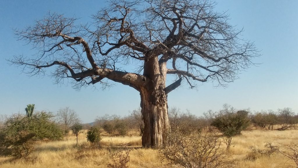
What the rain actually does
The reason rainfall matters to a safari is not comfort. It is three specific things.
Access. Black-cotton soil in the western Serengeti and the Ndutu area turns to grease when wet, and some tracks close. Katavi, in TANAPA’s words, is “only accessible in the dry months”. Saadani has parts that are inaccessible in the green season. A wet-season itinerary is a smaller itinerary.
Visibility. Grass grows. In the dry months the plains are cropped short and an animal at 300 metres is obvious; in April it may be 30 metres away and invisible. This, not the rain itself, is the main reason the dry season is better for game viewing.
Concentration. When seasonal water dries up, animals must come to permanent water, and permanent water is a small number of known places. That is the whole basis of Katavi, Ruaha and Tarangire late in their dry seasons.
Against that, the wet season gives you newborn animals, migrant birds, dramatic light, far fewer vehicles and lower rates. It is a genuine choice, not a consolation prize — but it is a choice, and it should be made knowingly.
Frequently asked questions about when to visit Tanzania
What is the single best month?
There is no single month, because the country runs two calendars. For the northern circuit and the islands, June to September is the most reliable window and January to February the most underrated — with the caveat, for this coming season only, that TMA expects off-seasonal rains to run into January 2027. For the southern and western parks, June to October is the window, and it is both longer and drier than the north’s. If your trip includes both, you are choosing which half to optimise for.
Are the “short rains” in November?
TMA defines Vuli as October to December and publishes its forecast under that title, so November is inside the season rather than its beginning. Onset starts in the Lake Victoria basin and reaches the northern circuit and the coast weeks later, and the forecast date for that has moved a long way between recent seasons: TMA put it in the first and second week of November for 2025, and in the first and second week of October for 2026. Plan the shape of the trip around the October-to-December season; read the start date off the current outlook.
Is January a good month in the south?
It is the middle of the rains there. Msimu runs November to April or May in one block, and the January dry gap is a bimodal-zone phenomenon that does not apply to Ruaha, Katavi, Mahale or the southern highlands. Whether the back half of the season turns out wetter than the front half is a matter for each year’s outlook — TMA forecast that for 2025/26 — so it is worth reading the current one rather than treating it as a rule. Nyerere is the partial exception: TANAPA describes the park as “green and absolutely beautiful from December to February, with many parts easily accessible”.
How cold does it actually get?
Colder than most people pack for. TMA puts the cool season at May to August, and its forecast minima for September 2026 ran 13–20 °C in the north-eastern highlands with high ground below 13 °C, and 8–18 °C in the south-western highlands. The lowest daily minimum TMA recorded anywhere in 2025 was 4.2 °C. Morning game drives at altitude and the Ngorongoro crater rim are the cold places; the coast never is.
Can I see the migration river crossings if I go in a particular month?
You can improve the odds and you cannot fix them. The published analysis of fifteen years of Mara River data — counted, as the paper is careful to say, on the Kenyan portion of the river — found the herd arriving anywhere between early June and late July, and crossings occurring on 52 ± 16 days a year. A 2025 satellite study raises reduced crossing into Kenya as one possible explanation for its own low count, but hedges it, and its December 2025 correction deleted the collar data that had been offered in support; it is a hypothesis, not a record of what happened. No Tanzanian authority publishes a month-by-month location calendar, and TANAPA’s own two statements about Serengeti timing do not match each other. Base yourself in the right part of the park for several nights rather than booking a day, and treat any guarantee as a warning.
Is the rainy season cheaper?
Accommodation, substantially. Park fees, barely. TANAPA’s low-season conservation rate applies to five parks only and runs a narrow window inside the long rains; everywhere else charges the same rate all year. The numbers and the exact dates are in how much a Tanzania safari costs.
Will a wet-season trip be ruined?
Rain in Tanzania is usually concentrated rather than continuous — an afternoon storm rather than a grey day — and the risk is less that you get wet than that a track closes or the grass hides the animals. Some parks absorb it well. Katavi does not. Ask the operator specifically which parts of the proposed route become unreliable in your month, and whether any camp on the itinerary closes seasonally.
Does Zanzibar follow the same calendar as the safari parks?
The same as the northern ones, yes — Unguja, Pemba and Mafia are all in TMA’s bimodal northern coast zone. The southern coast, including Kilwa and Mikindani, is not; it is unimodal.
When should I book?
Timing pressure in Tanzania comes from bed capacity rather than from permits. The small camps in the northern Serengeti during the dry months, and the fly-in camps in Katavi and Mahale during their short access window, are the places that fill first, because there are very few of them. Nothing on this site is booked here — enquiries go to the operator running the trip — but the practical answer is that the more remote and seasonal the property, the earlier the conversation needs to start.
Where this leads next
When you go decides how much you can fit in, what it costs and how you travel between places. Those are the next three questions.
- How many days do you need in Tanzania — what each trip length genuinely holds, and what the driving takes back.
- How much does a Tanzania safari cost — the published park fees, dated and sourced, and what sits on top of them.
- Getting around Tanzania — flights, roads, rail and ferries, and what the rains do to each.
- Tanzania travel requirements — visas, health rules and entry.
- Climbing Kilimanjaro: what to know — the climbing windows in the context of the whole decision.
For what each month actually buys you on the ground, the activity guides go into the experiences themselves: wildlife safaris, walking safaris, boat safaris, birding, beach holidays and camping safaris.
Choosing a trip around your dates
This site does not sell trips, take bookings or handle payments. It lists safaris run by Tanzania’s own tour operators, so that a route can be compared against a calendar in one place. An enquiry goes to the operator who runs the trip.
Browse the safaris listed by Tanzanian operators, read about the companies behind them, or start from the destination guides if the place matters more to you than the month. Then tell the operator your dates and ask them which parts of their own itinerary they would change because of them — the answer is informative either way.